The past couple of post have been a bit vague about how bad the threat of a huge warm-up looked, because I wanted to hedge my bets and not be a huge Debbie Downer. And, as often happens in long range weather speculation (there’s a reason I don’t say “forecast” here), things have changed. Luckily for the better (also known as “reverting to the mean”). Now that the threat seems to be ebbing, here’s what I saw, what I’m seeing, and what it might mean.
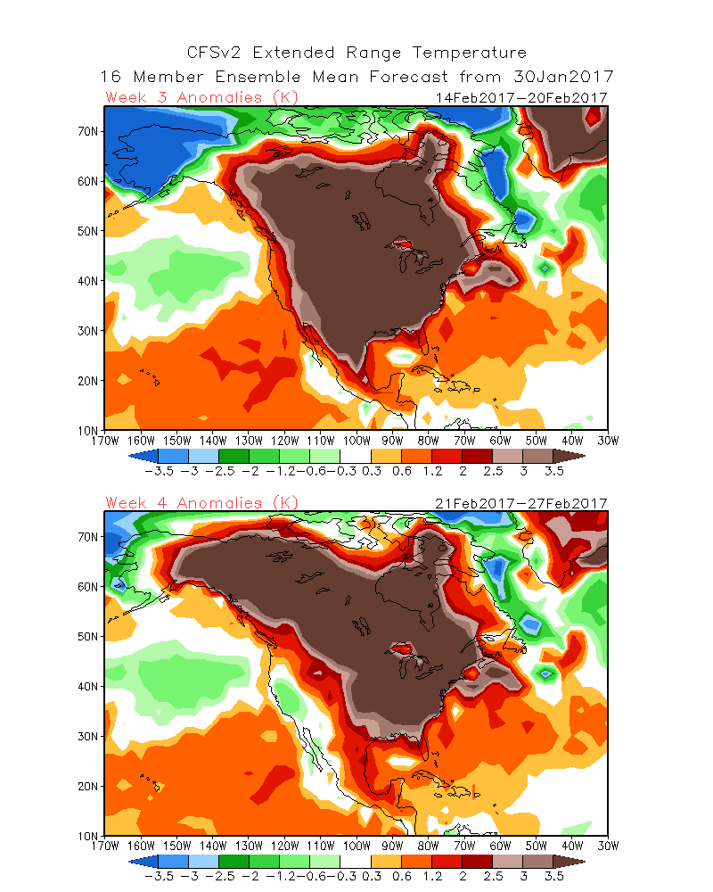
 Here’s what we saw about a week ago. This was the four week extended model at that point showed a large positive temperature anomaly stretched across the continent: the kind of temperatures which would lead to 40˚ temperatures in the northwoods which could eat away at the base. (See the map at right.) The weather models didn’t look much better, with temperatures looking to take a week-long ride above freezing.
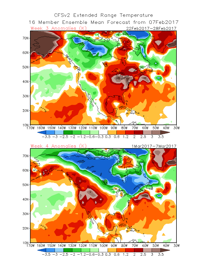
This persisted for a few days, but recent maps have looked a lot better. We’re still looking at some positive temperature anomalies, but not to the same extent. The shorter-range models do show some warming temperatures this week and next, but staying in the 30s, with little liquid precipitation and the chance for some snow. And the week of the Birkie itself looks cooler, so we shouldn’t have a repeat of last year.
All this, of course, can and will change. There’s very little skill predicting the temperature out beyond a few days, and anything past a week is generally just looking at trends. Still, I’d much rather have trends point to normal temperatures than way above.