Weather speculation: the picture gets … clearer?

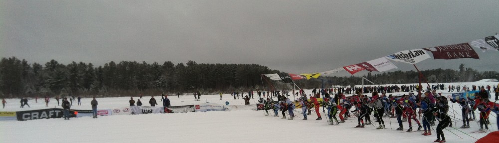
We’re going to have a ski race on Saturday.

The weather is going to be … interesting.

The Birkie hasn’t flirted the freezing mark at the start, except for the 2007 debacle, in nearly a decade and a half. The last few years have been cold. And this year? It is not going to be cold. It is going to rain. It’s not going to be warm enough and rain enough that the course will melt off and disappear, but it’s not the usual ski forecast of “soft ski, fine grind, hard wax” for glide and “something in the neighborhood of blue” for kick.

So let’s get to weather. It’s been cold in Birkieland for the last few days. Like -20 overnight cold. So the base—a foot-plus in the woods packed on the trails—is cold, and the ground below it cold. That’s good. It’s going to get warm. Not hot, but certainly warm. On Thursday, after a chilly start, temperatures will rise in to the mid-30s in the afternoon, and won’t go down overnight, making a run towards 40˚ in the overnight hours. On Friday morning temperatures will be in the high 30s with a burst of precipitation, about a third of an inch of rain, falling (maybe less, maybe as much as half an inch; the models aren’t particularly congealed yet). This will be with a passing cold front but that will usher a drier but still Pacific-origin air mass, so it won’t get much colder.

Friday will stay in the 30s or maybe low 40s during the day, which may vary across the trail. What this does to the snow will be interesting. The rain will fall and percolate down through the pack, but may freeze in to the snowpack more than anything since it will retain a lot of cold. There should be enough time for it to freeze in and drain away before the race on Saturday, but it will be interesting. Friday night will be very interesting: temperatures in the 34˚ range will make for a much different race than temperatures in the 29˚ range. Although if the trail is packed, it might freeze up well enough, at least for earlier racers. Right now, it looks like it will drop to right around freezing, maybe a little above, but different parts of the trail may behave differently. So, really, all bets are off in regards to trail conditions.

Saturday appears to be in the mid-30s, breezy, mostly cloudy with a west-northwest crosswind. It will be like 2007, actually, except without a) a shortened race and b) a snowstorm in the evening.

As for the base, it should be fine. In 2000, a fifteen inch base was vaporized over the course of a week before the race (see the chart below). This year, luckily, the meltdown will be much more muted, we won’t have three days with temperatures staying above 40 overnight, and won’t have highs at or near 50 for most of the week before the race. About the same amount of rain, but 15˚ colder and falling on to snow that hasn’t been pre-warmed by a week of warm weather. In other words, it’s not perfect Birkie conditions, but we should be fine.

2000: not a happy time for the Birkie (data from Spooner via NWS):

2000-02-20 38 5 21.5 3.2 43 0 0.00 0.0 14
2000-02-21 43 17 30.0 11.3 35 0 0.00 0.0 11
2000-02-22 52 28 40.0 20.8 25 0 0.00 0.0 10
2000-02-23 48 24 36.0 16.4 29 0 0.19 0.0 8
2000-02-24 56 40 48.0 28.0 17 0 0.00 0.0 5
2000-02-25 51 41 46.0 25.5 19 0 0.33 0.0 1
= No Race 52 40 46.0 25.1 19 0 T 0.0 T

Paul Huttner is calling this a mega-thaw. Well, that was a giga-thaw.

So freak out about wax, and how your body will do in these balmy conditions. But don’t sweat (ha!) the course, we’ll have snow from Cable to Hayward. It just won’t be soft and powdery. But we’ve had eight Birkies in a row with good snow and Main Street finishes, and this should, barring a major downturn, be a ninth.

Weather Speculation: Warmer

So, uh, don’t panic.

But get a little worried.

The Birkie Trail should be fine for the race as long as it doesn’t rain too much or get way in to the 40s (but, uh, it might, which could be very, very interesting). It will be warm for the 24 hours preceding Saturday morning (but it might—might—dip to freezing on Friday night) and it is not going to have the usual squeaky-snow Midwestern feel to the race. Welcome to the East Coast/California, folks! Warm and slushy or maybe icy, too.

Fluoros? Yeah, they’ll matter. Flex and grind? Yup, them too. Rilling? Oh, yeah, you’ll want to rill. Wax? Ha, klister, all klister. Get our your blowtorches, classic skiers.

And for god’s sake do not ski on the trail on Thursday or Friday.

Weather Speculation: Roll up your sleeves

It’s going to be warm.

Like, not warm enough to melt the snow, so we should have a race. But a heck of a lot warmer than any Birkie in recent memory.

Monday through Wednesday this week will be seasonable: highs in the 20s, lows around 10, with maybe an inch of snow here and there. Then it gets interesting.

Thursday should be cold to start, but warmer as the day goes on. Luckily snow goes down on Wednesday night on Main Street (I think) so it should set up well when temperatures are still around zero. Thursday will go up to around freezing, and then not go down. Friday will be the warmest day. It will likely be cloudy and in the 30s, with some light rain or drizzle (yes, rain). Nothing that will wash the snow away, but certainly something that will put some moisture in to it. The snowpack will be quite cold and retain a lot of latent cold in it, as will the ground, so it is unlikely to get soft if the temperatures stay below 40.

Then things get really interesting Friday night. Current guidance shows the low temperatures dropping to right around 30 as a weak cold front comes through. If temperatures stay above freezing, the course may begin to soften given the time above freezing. If they drop, say, to 28, the course may freeze from above and below and could be lightning fast and solid, a good day for stiff skis with good edges. Glide wax will matter, and it will matter a lot more if it’s 33˚ at race time versus 28˚. And the course may change during the race, with firmer conditions at the start that soften as we go south and as the sun comes out, which may or may not happen. Oh, and it’s possible there will be some light wet snow overnight. So as for kick wax: good luck, classic skiers. It may be a day that waxless skis take the day.

This is not one of those years where we know the weather ahead of time, because while 5 degrees makes very little difference between 5˚ and 10˚, but a whole heck of a lot of difference between 29˚ and 34˚.

This Birkie is going to be interesting. Fun, and interesting.

The good news is that Saturday afternoon may be 35˚ and sunny, so get ready for a party on the lake. I’ll get the New Glarus.

Weather Speculation: A Balmier Birkie?

1998 to 2007 was a dark period for the Birkie. The race in 2000 was canceled, 1998 and 2007 were shortened significantly, 2002 finished short of Main Street, and 1996 had race temperatures well in to the 40s; I can only imagine that it was a soggy, slushy Birkie. (Our weather history chart is here; I’ll update it soon with more recent data.)

Since then, we’ve had a run of good luck. Even in 2012, where there was hardly any snow south of Birkie, the course was perfect. The only downside has been the cold; some of the coldest Birkies have been held in the past decade. Still, eight races with pretty much perfect snow in a row is not too shabby, especially in a time of warming temperatures across the globe. If you’d told me after we skied 25k on rock skis and slush in 2007 that we’d have perfect snow for the next decade, it would have sounded like wishful thinking in a year where there wasn’t more than three inches of snow on the trail before race day.

This year shouldn’t lack for snow; there’s enough on the trail (although more would be nice) and we’re unlikely to face a 2000-esque meltdown (when 15 inches were washed away in a few days), but unlike most of the races in the past few years, it won’t be cold at the start. So you can leave your buffs, dermatone and maybe even wind briefs at home; it’s very unlikely that we’ll need a “-” in front of the temperature, at least not in Farenheit.

We might not even need it in Celcius. The two models are getting in to range, and both show a warm up at the end of next week. The European model shows temperatures peaking on Friday night just above freezing, with a mix of rain and snow falling on race morning. This would be interesting to say the least, and would cause a run on fluoros at the local ski shops. The American model brings the warm air in a bit earlier, with temperatures in the 30s on Friday, but falling back through the 20s on Friday night. With any moisture added to the snow, this would create a lightning-fast track for Saturday morning. The Canadian model, for what it’s worth, parallels the American model with a cold front swinging through on Friday afternoon.

Unless the models are wildly wrong, there should be no real threat to having enough snow for the race and a ninth straight Birkie with good snow. But it might be the first time in a while the start of the race we won’t have to layer and layer and layer up.

Weather Speculation: two weeks to go

With two workweeks until the Birkie (including Presdident’s Day; it’s so close!) it’s time for another installment of weather speculation! Last week’s snowstorm dropped 6 to 8 inches of snow and pushed snow depths in to the foot-deep range, although the packed depth on the train is less than that. This definitely helped the long-term forecast for the Birkie! Sunday’s thaw in Hayward was moderate and short-lived, and it’s now cold with a bit of light powder falling. It looks to stay cold for the next week.

Over President’s Day weekend, temperatures will moderate somewhat. Not a huge thaw at this time, but highs closer to 0˚C than 0˚F (it may not clear 10 in Hayward from Monday until Sunday). It may get cooler again before the Birkie, but there is some long-range guidance which would point to a warming trend towards race day, possibly a cool morning with a warm afternoon (desirable) and possibly some sort of storm (less desirable). This is, of course, a long way out and is very, very likely to change, so don’t make your plans based on it quite yet.

Early weather speculation

It’s February, and if you’ve followed this blog in the past, you know that means that it’s time for Weather Speculation! As usual, we look at weather models and make wild guesses about the weather, although they are at least slightly educated guesses. There’s only 19 days until race day, so we can basically pinpoint to within a degree what the temperature will be when your wave hits the course in Cable. (Note: this is a lie.) Join in!

With an early race this year and snow on the ground, we just need to worry about a warm-up. As you heard on the BirkieGuide Podcast (Wait, you didn’t listen to the Podcast? What is wrong with you! Go, go download it and listen to it now!) there is a thin-but-solid base on the whole of the trail, that could be skied well tomorrow but is susceptible to melting and could use some more snow.

So basically we need one of two things to happen. Either a) it needs to stay below freezing for the next 19 days or b) it needs to snow. If both happen, all the better. Let’s see where we stand with the long-range forecasts:

a) Cold. So far, it’s been a warm winter east of the Rockies. The City of Lakes Loppet may be salvaged by a last-minute snowstorm after warm air melted a five inch base to a thin covering of slush and ice. January has been only a couple degrees above normal, but with wild temperature swings and a late-month thaw. That has passed, and the next few days look colder. Not cold, mind you. But colder. And colder is good enough in Northern Wisconsin in February. (There’s newly-available “NowData” from the NWS for Spooner dating back to 1895. That may be downloaded.) As for the weather, the current models are not showing any major warmups in the next two weeks. In the third week things get a bit dicier with warmer air dumping over the Rockies, but it looks to stay at bay until it gets warm in earnest in March. So this is qualified good news.

b) Snow. Of course, a couple of feet of snow would help out as well. A couple of feet we may not see, but the storm which has pushed north 50 miles in the last couple of days in to the Twin Cities is similarly pushing towards Hayward. It may drop [edit] 4–8 inches of snow on the Birkie Trail (with higher amounts at the south end, which if you listened to the podcast you would now is where it’s most needed, and the totals keep going up; the trend is your friend) this week, which would make everyone breathe easier. Not a blockbuster, but not nothing. Beyond that there are no huge blizzards on the horizon, but an inch here and there. Time will tell.

As for race-day weather, it is foolish to try to predict specific days more than a week out (and certainly not three), so I am not going to. Yet. It will be between -20 and 50 at race start. And most likely in the teens.

Lucky us

From here

The Birkie is Saturday. The forecast low temperature on Saturday morning? 10˚. That’s cold—a couple degrees below average—but not too bad.

The current temperature in Hayward? -30˚. Not with the windchill. It’s thirty

below in Hayward. Or as they say this time of year: “Thirty.”

We’re very luck the race is two days later. While the race has started in temperatures around or a bit below 0, there’s no way the Birkie could have held the race today without a significant delay. But the race can’t be pushed too far back because many later-wave skiers take several hours to get to Hayward, and darkness falls around 10. I would bet the Birkie staff is thanking their lucky stars this morning that they don’t have to deal with the logistics of a -30 race start.

See you Saturday!

Threading the needle

One of the great things about the Birkie is that you ski in whatever weather is thrown your way. 18″ of snow? Ski it. -11˚? Ski it. But it’s especially nice when it’s not brutally cold, or when you don’t have to push your car out of a snowbank the morning of the race. It won’t always be 2010-esque (10 at the start, 30 at the end, sunny on the lake) but we haven’t had a year with even moderate weather in quite some time.

And that might change, although it looks like we’ll be incredibly lucky. While last year the Upper Midwest was in the center of the cold air in the US and got shellacked with snow and cold, this year it’s more on the western edge. There’s less moisture but, at least in the past few weeks, no shortage of cold. Much of this month will dip below 0 in Hayward, and the next week or so looks especially cold. Hayward looks to go well below zero five of the next six months, and readings of -15 or -20 are not out of the question. The one exception? Birkie morning.

It might be downright balmy! A small disturbance will add a bit of fresh snow to the course (maybe even a post-grooming blanket to soften the well-packed base) and also keep temperatures from free-falling. Temperatures should drop to about 5 overnight, and rise to 15 during the race. Considering the rest of the week, this will be warm. Winds look to be light, and maybe even out of the north—a slight tail wind to propel us to Hayward.

In any case, a repeat of 2011 (frigid Birkie) or 2014 (the blizzard) are not likely in the cards. It should be a much easier race, logistically, and, compared to last year, physically as well.

Early weather speculation, and an update from the home front

Greetings!

It’s February, I’ve bought my plane ticket to the Birkie (you can even save a couple bucks using the Delta meeting code NMJDQ, see here), and there’s some snow on the Birkie Trail. Not feet, like last year, but enough. So things are looking okay for the race, which is barely more than two weeks away!

So, it’s time for some good weather speculation. Which might be paltry this year. In the past few years, we’ve had a lot of weather speculation. Is it going to snow? Is it going to be cold? Is it going to rain? And we’d do that this year, again (and by “we”, I mean “I”) except I’ll be abroad. No, I’m not taking a vacation to Cabo, or something silly like that. I’m off to Norway. Quick aside: plane tickets to Norway in the winter are pretty cheap, as are hotels. Why would you go in the summer anyway? I’m going for ski orienteering world championships (yup, a real thing) to ski for a week (oh, and I’m going to have a chance to ski around Oslo as well), and won’t have a ton of internet connectivity; I’m not sure how much. So I won’t be on top of all the model runs, and hope there’s lots of snow when I get back.

Right now? It looks pretty okay. The past few runs have shown cool and mostly dry weather heading towards Hayward, but hinted at a few inches of snow in the next week, and no warm ups in the near future. I’d take that.

Anyway, if anyone wants to take over Weather Speculation, let me know, and I’ll give you the Elite Wave credentials to get in to the site. (Okay, it’s a password.)

Of course, you know what else I’d take? 42″ of snow in a week. That’s what we just got in Boston. The old record was 31. Everything ground to a halt for a couple of days, but the skiing is great, and the scenery along the river spectacular. I may or may not have run across the frozen, windblown Charles the other day. If it crusts over, the river crust skiing would be epic. So I’ll try to send some karma the way of the Birkie. We don’t really need much more snow here, but we’ll take it.

Finally, a note on race reports. Several people have emailed me 2014 reports and I’ll try to post them, but I’m leaving for Norway on Friday and barely have time. Looking ahead, I’d love your reports for 2015. I am going to try to set up a blogging template on WordPress so that you can create your own race report (and I can do as little as possible …) but doubt that’s going to be in place. In lieu of that, a couple of guidelines to keep in mind (I’ll repost this after the race, but keep these in mind):

  • Please send me text with as little formatting as possible. I have to get it Internet-ready, so a PDF with in-line photos really doesn’t work. Sending the text in a plain word doc or the body of the email is best. I’m drawing the line this year. If I have to pull out carriage returns and such, I’m not posting it. Sorry.
  • I’ll post photos, but please send them as separate attachments.
  • Proofread! Please proofread. I have to proofread, and if there are fifteen spelling mistakes on the first page I might give up.
  • Consult a style guide. Use em dashes (—) and elipses (…) not double hyphens (–) and treble periods (…). And single spaces after punctuation. I’m amazed that is still a thing.
  • Keep it clean, and not ad hominem. If you want to call out a person who didn’t let you pass on a hill at 20k, don’t mention their number or name, unless it’s a buddy of yours.
There will probably be more. But keep ’em coming!
And see you soon in Hayward.

10 to 20 inches. Not even that speculative.

Holy smokes.

The storm is coming, and the models are not backing down. Everything has lined up for a textbook blizzard, and it is zeroing in on Birkieland. The National Weather Service has probabilistic snowfall forecasts (here) and it’s a doozy of a storm, with an epicenter pinpointing Hayward, Wisconsin. At the 10th percentile, Hayward would see 9″ of snow. At the 50th, the accumulation would be 16″ and at the 90th percentile, there’s the chance for 21″ of snow. In other words, it’s just as likely that Hayward gets 10″ of snow as it gets 20″. There’s an outside chance that only six inches falls, but about the same chance of two feet.

Wow.

While this will most likely cause some race-day disruptions, we can thank our lucky stars that it’s falling tonight, not tomorrow night. Two feet of snow on race morning would probably cause the race to be canceled due to too much snow. Even still, it is going to be a Herculean effort on the part of the Birkie staff to get the course, and the infrastructure, in place for the race. There are 5 Pisten Bullys set to groom, but expect a soft course. There’s close to 100k of trail to groom, and the groomers can only make so many passes. There is also a ton of plowing for parking, plowing on roads to get to Hayward, and, just, where do you put all the snow? Expect things to move a bit more slowly than usual.

On the other hand, Main Street is going to have very good coverage.

The snow will start out heavy and wet, but as the storm goes by will get lighter and dryer. Still, it may be a more moisture-ful snow than we’re used to in the Midwest, although once it gets cold it may turn in to powder anyway. I’d expect most of the snow to fall with temperatures in the mid- to upper-20s. Once the storm departs, expect some lingering snow, some blowing and drifting snow, and plummeting temperatures—likely below zero on Saturday morning. Luckily, winds should be light. And we’ll thread the needle again: one day earlier and we’d be in a blizzard, one day later and it might be -10.

This will be a very interesting Birkie.