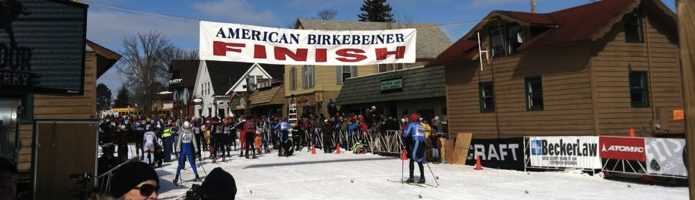
Wednesday Weather Speculation: Pre-Birkie Blizzard

So, there was some question on the models this afternoon as to where the western edge of the snow would be. The NAM model was an outlier and even suggested that the snow would only reach to the Minnesota-Wisconsin border, with only a few inches in Birkieland. As much as I like big snowstorms, big snowstorms the day before the Birkie create big headaches, so I was kind of, sort of maybe a little bit rooting for this model.

Well, it fell in to line behind the rest of the guidance, so, bring on the snow! Here’s the TL;DR version of the next few days, weatherwise; I’ll go in to more detail below:

  • Warm today! 40s in Hayward right now.
  • Cool but not cold tonight. Only in to the upper 20s, probably cool enough to freeze the base, not that it really matters.
  • Heavy snow begins tomorrow around noontime and continues through Friday morning. 8-12 inches. Don’t drive up tomorrow night. Just, don’t.
  • Temperatures drop from 30 to 10 during the storm, don’t budge tomorrow. Strong winds.
  • Race start temperature around -3, winds slacken somewhat.
  • High on Saturday around 10, wind chills remain below 0. Dress warm. Light snow may continue to race time. Soft skis.
And here’s the longer version. We’re looking at textbook Panhandle Hook storm, and I am going to give the award to the European Model which was on top of this a full week ago, although the GFS had the same idea, and even the NAM extension was clued in. The NAM has been wishy-washy, but the other models have held serve, and now it’s go time. The GFS’s most recent run spins up a real doozy of a storm, dropping well over a foot of snow on the Birkie Trail on Thursday evening; let’s all just thank God or Allah or the Flying Spaghetti Monster or whoever that it isn’t a day later; I don’t know if the race could be held with that much new snow. As it is, expect things to be slow on Friday. I don’t expect a foot and a half, but 12″ is not out of the question. It should be dry and powdery by the end, and it will be compressed but you can only knock so much air out of the snow, especially if it’s still falling until Saturday morning and blowing. The course will be soft.
Then there’s the cold. We should be used to this, because about half of recent races have started at or below zero (here’s our weather history page). The added rub here is that it may be windy. The models look to slacken the winds in the evening, which would be preferable, but if they don’t we’ll have a nice breeze from the west. Guess what direction the start goes? Due west. Guess what direction the second power line segment (after the turn) is? Due west. Get ready for a headwind at the start.
Once in the trees it should be pretty nice. Mostly cloudy (so no need for sunscreen, plus most of your face will be covered anyway) and perhaps some light snow. Yup, soft skis.
So, take it easy getting to Hayward, watch for blowing and drifting on Friday, and leave some extra time on Saturday morning. It will be a soft Birkie, but there is going to be an amazing amount of snow. And I think we can all agree that that is a good thing!

Tuesday Weather Speculation

You know what, guys? It’s going to be a damn good Birkie.

The NWS has hoisted a winter storm watch, so we’re looking at six or more inches of snow. It will start off moist (base) and then get dry and powdery as it gets cold and the storm pulls off. Friday will be chilly and windy, and Saturday morning looks cold and dry. The race will probably start either side of 0. Wind briefs and buffs will be the order of the day.

It was 38 in Hayward today, and should be 38 tomorrow. A dry, sunny 38 which will just serve to put a few ice crystals in to the base. However, if there’s enough snow these might not even get tilled up, so the race should be powdery. Soft-medium flex skis will be in order with a fine grind. Fluoros if you must, but cold powder is Start Green.

Notes on hyperbole

You may be enjoying our annual weather speculation. Do note, we freak out about everything. Including a few days of 38˚ weather. (Okay, not really; we just don’t want it to be 38 on race day. And it won’t be.) There’s a foot of snow compacted on the trail. Not a foot in the woods (there’s two feet of snow pack in the woods), a foot on the groomed, packed and tilled trail. Back in the day I ran some data of previous meltdowns in the Twin Cities when we were looking down the pike a some warm weather and the conclusion was that in January it’s damn near impossible to melt a foot of snow. A little easier in February (higher sun angle) but it ain’t happening unless it’s 50 for the next few days. And rains.

Skinnyski is saying don’t panic. If there were marginal conditions, we’d be hanging on every degree. As the second linked article mentions, the only difference 38 vs 41 will make is how much transformed snow forms up top to till in to the base. It will just make it faster. Weather speculation is full of hyperbole because it’s just that, speculation. It’s almost more fun when there is some question about conditions in marginal years, although I’d much rather have this kind of weather every time. A month ago, I posted that we’d be fine. It’s been above freezing exactly zero times since then. So, yeah. Birkie. It’s happening, guys.

Monday weather speculation

It might be really effin’ cold for the Birkie.

Just going to put that out there.

But first, Thursday. If you’re flying in on Thursday night, be forewarned that there may be some snow in MSP. Probably not enough to cancel flights, but maybe enough to allow you to move your flights around if things get tricky. Up in Hayward, you’ll probably see 2-4 inches of new snow, starting a little wetter and then, as the temperature drops, getting dry and powdery. This will be on top of a base which will see sun and temperatures in the 30s for the next two days, so the surface will transform in places (but perhaps not on north-facing uphills, which are most hills in the race). With new snow and lots of grooming, I would expect a course much like in 2011: mostly cold snow with a little ice mixed in to keep it fast, but not enough to require klister or anything.

On to the temperatures. They’ve been trending downwards. While at first it looked like the warmer air might hang on in to Birkie day, it now looks like it will depart on Thursday night. As high pressure settles in, winds will slacken. If they go calm on Friday night, with new snow, the temperature will drop, and we could make a run at the all-time record (-14) or the 2011 mark (-11). Luckily, we only get that cold if there’s no wind, so wind chills won’t be worse. And given the high sun angle, it should warm nicely, albeit only in to the teens, not the 30s. If it were early January, we wouldn’t be seeing zero.

Now things can change, and it could be warmer for the race. But the trends I’m seeing suggest colder. The NWS has been dropping their forecast temperature gradually, but they often build a regression to the mean in to long range forecasts. If the trends hold, make sure you don’t forget your wind briefs.

Weather speculation: Start waxing your softer skis

So after threat upon threat of a thaw seemed like a major possibility, recent guidance has pushed the freezing line southwards. It now appears that any warm temperatures in Birkieland will be minimally above freezing, quite possibly not enough to transform much snow. In addition, while the storm later in the week has been drifting off the models, a storm closer in—on Monday—should drop several inches of fresh snow on the course.

In other words: there will be a lot of snow on the course!

What we’re looking at are highs in the low 30s during the week—Tuesday, Wednesday and Thursday. There’s then a chance of snow on Friday, and with it cooler temperatures, with highs in the 20s. This should allow the course to set up nicely, but likely with some new snow groomed in, so it won’t be an icy, frozen base. An early call for Saturday would be temperatures around 10, perhaps a slightly breeze from the northwest, and some lingering snow.

But this can, and will change. So wax up those softer skis. Or leave them for the pros (shameless promotion of advertisers, look to the left). Also note that if you need last-minute lodging, check this out.

169 hours weather speculation

We are one week and one hour (and four minutes as I type) from the start of the Elite Mens freestyle race. One. Week. Away.

Here’s what’s going on with weather speculation.

The GFS has backed off of any real warm-up, and looks cold and dry for the race, with a few inches of snow midweek. It had been showing a “Panhandle Hook” type of storm before the Birkie, this is now delayed until Saturday evening and only a few inches of snow.

The ECMWF has the hook coming through on Thursday, and then colder weather for the race.

If I had to guess right now, I’d guess some fresh snow with some refreeze mixed in, temperatures at the start around 10. So it will probably be 30 and blizzarding; we’ll see.

(Anyone else catch MPR news drop the B-word yesterday?)

Weather Speculation: One week to go!

In a week, I’ll be in Hayward.

Let me take some ibuprofen; my fever has gotten high. And repeat:

IN A WEEK, I’LL BE IN HAYWARD. Say it with me. Again and again. There is no cure for the fever.

On to weather speculation. In the past day or so, the models have backed off of the very warm temperatures—to a degree. It looks like we won’t see temperatures breaching the 40 degree mark, and with cool nights the snow, if it transforms, will do so minimally. Then, there’s new snow. A few inches on Monday are likely. Then warmer Tuesday through Thursday.

After that is a wild card. The models have been flip-flopping, but a relatively constant theme is some snow. Some (the 00Z run of the Euro, for instance) have shown warm, wet snow the day before the race. Others (the 12Z GFS) show a cold front swinging through and more southeast weather system, which would bring several inches of cold powder during the race. But it could be a particularly white Birkie this year.

And it should be a nice ride for the next few weeks. Stay tuned!

We’re getting closer and closer

“I don’t know whether the weather will improve.”

10 points if you get that Simpsons reference.

Anyway, the weather a week out looks, well, interesting. After two months the polar vortex (I’m not going to get in to explaining how it’s actually a thing that the news media latched on to because it sounded cool and bastardized) is retreating back to its home near, well, near the pole, allowing a more westerly flow from the Pacific to feed slightly warmer air in to the region. So instead of highs around 5, the highs will peak in to the 30s next week.

And what does this mean for the Birkie? Well, several things:

  • First, this is not a catastrophic melt. It would have to be 60 to really scare me. The race will go on!
  • There should be a couple of rounds of snow this week and weekend, so the base will get something new on top.
  • If it just gets to 35 a couple of days without much sunshine, the snow may not transform. Or if it does, only the very top layer will get wet and refreeze. With good grooming (there’s always good grooming) this would mean that it would be soft conditions but with some ice mixed in, so faster.
  • However, if it gets to 40, or it rains, the liquid may penetrate deeper. If this happens, expect it to refreeze more solidly, resulting in a firmer course.
  • Recent models have trended a bit cooler for race day, so I’d expect it not to be sloppy. Whether it’s powder or refreeze, well, time will tell.
There’s a lot of time, weatherwise, between now and then. But not much time Birkiewise! Get that fever!

Weather Speculation: Birkie Meltdown?

No, no, we’re not about to lose two feet of base and have no race at all. But it might go above freezing before race day. For the past few model runs, we’ve seen a sign that it could hit 40 in Hayward the week before the Birkie. I know, right, 40! It hasn’t been 40 since November, basically. It looks like a few inches of snow this week, and then the potential warm-up next week.

What does this mean for the race? Well, it means that with 40, a bit of rain or ice and then a freeze, it might be a pretty solid race compared with what we’ve seen the past few years. How long it comes before the race will be interesting; a couple model runs have pushed the warm weather all the way to Friday, which would mean the potential for a slushy, not frozen race. I’m hoping for frozen or powdery. But time will tell.

Weather Speculation begins in earnest

If you’re new to this site, one of the services we provide is weather speculation. Some years (and you can scroll through all of our weather speculation posts here) speculation is whether the base will hold until the race, and whether we’ll be looking at a shortened race or whether we’ll have anything to ski on at all.

This is not one of those years. Last year, with two weeks before the race, we only had a few inches of base. The year before—when there was not a lick of snow south of Spooner on race day—my forecast for two weeks before race day was for a 30% chance that the race would be significantly curtailed or canceled. Even the year before that, in 2011, a week-before meltdown saw temperatures soar to 50º and snow shrivel from the trail.

This year? I think we’re good. There has been deep snow on the Birkie Trail all year, 1½ to 2 feet of it, and it hasn’t gone anywhere. Since the beginning of December in Hayward, it has gone above freezing once, for eight hours, reaching 37º. It’s been below zero most every night. That’s a cold, hard base. There hasn’t been a ton of snow, but there hasn’t been a lick of melt.

And the next few weeks look pretty solid. First of all, it’s an early Birkie this year, so that buys us a week of not having to worry about an early spring. For the next week, temperatures in Hayward look to stay nice and chilly, like the season has been going so far. Highs 5 to 15 above, lows 5 to 15 below. The week after looks a bit more up in the air, with some potential for flirtation with the freezing mark, but also potential for precipitation. It will likely be in the form of snow, but even a rainstorm at this juncture won’t put a dent in the snow. The only issue would be a week of temperatures in the 50s, and that doesn’t appear to be in the cards.

Of course, we’ll keep an eye on it all.